

Atlas of World War II: History's Greatest Conflict Revealed Through Rare Wartime Maps and New Cartography
Product Description
Atlas of World War II: History's Greatest Conflict Revealed Through Rare Wartime Maps and New Cartography
This definitive, lavishly illustrated book from National Geographic features an astonishing array of vintage and newly created maps, rare photographs, covert documents, and eyewitness accounts that illuminate the world’s greatest conflict.
This magnificent atlas delves into the cartographic history of WWII: naval, land, and aerial attacks from the invasion of Poland to Pearl Harbor and the Battle of the Bulge. Rare maps include a detailed Germany & Approaches map used by Allied forces in the final stages of the war, full large-scale wartime maps of the world used by President Roosevelt, and crucial Pacific theater maps used by B-17 pilots. Satellite data renders terrain as never before seen, highlighting countries and continents in stunning detail to include the towns, cities, provinces and transportation roads for a pinpoint-accurate depiction of army movements and alliances. Gripping wartime stories from these hallowed fields of battle, along with photographs, sketches, confidential documents, and artifacts color the rest of this timeless and informative book.
Technical Specifications
You might also like

The Secret History of World War II: Spies, Code Breakers, and Covert Operations

National Geographic Atlas of WWII
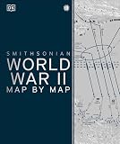
World War II Map by Map

World War II: The Definitive Visual History from Blitzkrieg to the Atom Bomb

The Allies: Roosevelt, Churchill, Stalin, and the Unlikely Alliance That Won World War II

Atlas of the Civil War: A Complete Guide to the Tactics and Terrain of Battle

Eyewitness to World War II: Unforgettable Stories and Photographs From History's Greatest Conflict

National Geographic Atlas of The Civil War

World War II at Sea: A Global History