

E1 GNSS IMU RTK GPS Surveying Equipment Rover with Poles Receiver Rtk Gnss Handheld Collector Survey Software, 1408 Channels, 1cm Accuracy, 5km Distance

Product Description
E1 GNSS IMU RTK GPS Surveying Equipment Rover with Poles Receiver Rtk Gnss Handheld Collector Survey Software, 1408 Channels, 1cm Accuracy, 5km Distance
- 【Full-Constellation, Fixed in Seconds】E1 achieves stable fixed solution rapidly, even in challenging environments like multipath, tree canopy, and city canyons.E1 is equipped with a high-precision GNSS engine for simultaneously tracking GPS, BDS, GLONASS, Galileo, QZSS, IRNSS & SBAS.
- 【Smaller, Lighter】E1 is compact and lightweight, with dimensions of Φ133.5 mm × 67 mm and a weight of 870g, ensuring ease of use without sacrificing performance.
- 【Over 20hrs Operation】With optimized charging safety and internal battery design, E1 offers over 20 hours of continuous operation on a single charge, with fast charging support via Type-C port.
- 【5 Kilometers】E1 RTK GNSS Surveying System with IMU has a long transmission distance, Radio range between the rover and the base can reach 5 kilometers (3.1miles). Also E1 can compatible with base stations of other brands in both Radio and CORS mode. Support RTCM v3/CMR correction data transmission.
- 【60° Tilt, 5s Initialization】Equipped with a new generation IMU module, E1 initializes in just 5 seconds and allows tilt measurements up to 60°, ensuring ±2.5cm accuracy for the entire work.
- 【Notes】The handheld measurement software is installed and permanently available. Product includes 5/8" threaded range rod.
- Note: U.S. users must apply for an FCC radio license for commercial use (e.g., surveying, construction) with the UHF function (450–470 MHz). The device is FCC certified, and we can provide supporting info if needed.
Technical Specifications
You might also like
Cellularize Tempered Glass Screen Protector Compatible with Nintendo Switch [Anti-Scratch] [Bubble-Free][3 Pack]

Halter Standing Desk Converter for Computer Laptop or Dual Monitor Adjustable Stand Up Desk for Home Office Sit Stand Desk Riser with Keyboard Tray Cherry 36 Inches

Under Armour Unisex Golf Towel

BIODROGA Medical Institute - Even & Perfect DD Cream Dark SPF 25 30 ml - Face Cream, Complexion Optimisation, UV Protection, Concealing Imperfections, Care Cream, Paraben-Free, Silicone-Free

MAREE Face Moisturizer – Firming & Lifting Face Cream for Women with Collagen, Retinol & Hyaluronic Acid – Day & Night Anti-Aging Facial Wrinkle DD Cream Moisturizer for Dry Skin – Crema Para la Cara

MAREE Face Moisturizer – 24H Hydration Face Cream for Women with Collagen, Retinol & Hyaluronic Acid – Day & Night Anti-Aging Facial Wrinkle DD Cream – Moisturizer for Dry Skin – Crema Para la Cara
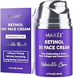
MAREE Face Moisturizer – Retinol Face Cream for Women Moisturizing with Collagen & Hyaluronic Acid – Day & Night Anti-Aging Facial Wrinkle DD Cream Moisturizer for Dry Skin – Crema Para la Cara
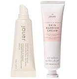
Jouer Skin Barrier Cream & Vanilla Lip Enhancer