

Laminated Virgin Islands (U.S. & British) Map by Borch (English Edition)
Product Description
Laminated Virgin Islands (U.S. & British) Map by Borch (English Edition)
Folded laminated road and travel map, in color. Scale 1:80,000. Legend includes sights, museums, churches, synagogues, archaeological sites, castles, ruins, windmills, towers, caves, beaches, yachting, windsurfing, snorkelling, scuba diving, hospitals, golf courses, parking, petrol stations, international/regional airports, national parks, national monuments, nature reserves, camping sites, viewpoints, hotels, markets, cliffs, reefs. Includes inset map of St. Croix (1:80,000), Charlotte Amalie (1:15,000), Charlotte Amalie Historic District (1:7,500), Cruz bay (1:15,000), Christiansted (1:15,000), Frederiksted (1:15,000), Anegada (1:80,000), Road Town (1:15,000), The Valley (Spanish Town), Lesser Antilles (1:7,000,000). Climate charts show the average daily temperatures, humidity, hours of sunshine and precipitation for each month. Extensive index.
Technical Specifications
You might also like

Fodor's U.S. & British Virgin Islands (Full-color Travel Guide)

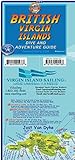
British Virgin Islands BVI Adventure & Dive Map Franko Maps Laminated Poster
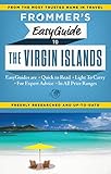
Frommer's EasyGuide to the Virgin Islands (Easy Guides)

U.S. Virgin Islands Adventure Guide & Dive Map

Virgin Islands, US & British (English and German Edition)

Puerto Rico (National Geographic Adventure Map)
British Virgin Islands Dive Guide BVI Waterproof Map Franko Maps
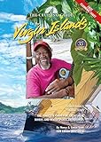
The 2017-2018 Cruising Guide to the Virgin Islands

Virgin Islands National Park (National Geographic Trails Illustrated Map (236))