
Books > Self Service > Special Features Stores > 34875086-8a6a-4dfe-b095-4d85fb30b3ba_0 > 34875086-8a6a-4dfe-b095-4d85fb30b3ba_5001 > Sponsored Selections
![Mount Rogers National Recreation Area Map [Jefferson National Forest] (National Geographic Trails Illustrated Map, 786)](https://m.media-amazon.com/images/I/51aMvwGPO-L._SL500_.jpg)
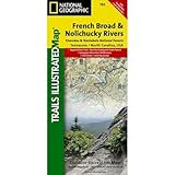
Mount Rogers National Recreation Area Map [Jefferson National Forest] (National Geographic Trails Illustrated Map, 786)
Product ID: 1566953138
Condition: New
Payflex: Pay in 4 interest-free payments of R216.50. Read the FAQ
R 866
includes Duties & VAT
Delivery: 10-20 working days
Ships from USA warehouse.
Secure Transaction
VISA
Mastercard
payflex
ozow
Product Description
Mount Rogers National Recreation Area Map [Jefferson National Forest] (National Geographic Trails Illustrated Map, 786)
- Mount Rogers National Recreation Area [Jefferson N
- MT. ROGERS NRA
- National Geographic Maps
• Waterproof • Tear-Resistant • Topographic Map
Coverage includes Jefferson National Forest. Towns: Wytheville, Galax, Marion, Damascus, Abingdon. Wilderness Areas: Lewis Fork, Little Dry Run, Little Wildon Creek. Major Trails: Appalachian National Scenic Trail, VA Creeper Trail, VA Highlands and Iron Mountain Horse Trails. Other Highlights: Grayson Highlands, Hungry Mother, and New River Trail State Parks. Includes UTM tick marks for use with your GPS unit and a trail mileage matrix.
Coverage includes Jefferson National Forest. Towns: Wytheville, Galax, Marion, Damascus, Abingdon. Wilderness Areas: Lewis Fork, Little Dry Run, Little Wildon Creek. Major Trails: Appalachian National Scenic Trail, VA Creeper Trail, VA Highlands and Iron Mountain Horse Trails. Other Highlights: Grayson Highlands, Hungry Mother, and New River Trail State Parks. Includes UTM tick marks for use with your GPS unit and a trail mileage matrix.
- Map Scale = 1:75,000
- Sheet Size = 37.75" x 25.5"
- Folded Size = 4.25" x 9.25"
Technical Specifications
Country
USA
Brand
National Geographic
Manufacturer
National Geographic Maps
Binding
Map
PartNumber
TI00000786
Model
NatGeo Maps: Trails Illustrated
Warranty
Limited Warranty
Color
No Results
IsAdultProduct
Height
8.7
Length
4.2
Weight
0.20062065842
Width
0.3
NumberOfItems
1
Customers who bought this also bought

You might also like

Mount Rogers High Country [Grayson Highlands State Park] (National Geographic Trails Illustrated Map)

Blacksburg, New River Valley: Jefferson National Forest, Virginia (National Geographic Trails Illustrated Map)

Linville Gorge, Mount Mitchell [Pisgah National Forest] (National Geographic Trails Illustrated Map)

Mount Rogers National Recreation Area Guidebook: A Complete Resource for Outdoor Enthusiasts

New River Blueway (National Geographic Trails Illustrated Map)