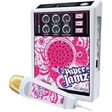
NAVA F60 Handheld GPS Navigation Survey Device, Handheld GPS for Hiking, High Performance Handheld GPS Topografia,Fully Featured with 3-axile, Electronic Compass, Barometric Altimeter and Thermometer
NAVA F60 is a handheld GPS and GLONASS receiver, with its high-sensitivity, WAAS, EGNOS, GAGAN, MSAS-enable GPS receiver, NAVA F60 locates your position quickly and precisely and maintains its GPS location even in heavy cover and deep canyons.
NAVA F60 has an enhanced 2.2", 65K color, 240x320 pixels, sunlight-readable display. Durable, portable and waterproof.
Worldwide basemap preloaded, and NAVA F60 also supports Vector map (City detail map), DEM map, and Raster map.
NAVA F60 lets you share your waypoints, tracks, routes in multiple GPS data formats, including GPX, SHP, MIF, CSV, KML, DXF, and TXT via NAVA GPS Office software.
NAVA F60 is an ideal rugged GPS and GLONASS receiver for a large range of applications from Agriculture, Forest and Biology, Mining, Surveying, Nautical, Hydrographic studies, Engineering disciplines,Geographical (GIS) and Urban information systems,Municipalities and Public works directorates, Electricity, Electronics, Geological studies, Sporting, National Real Estate-land survey directorates, Remote sensing, Public sector and institutions, Planning and First draft projects.
Barometric altimeter, 3-axis E-compass, Thermometer,Support switching between English, French, Portuguese, and Spanish.