

HUNT Montana Public/Private Land Ownership Topo Maps for Garmin GPS by onXmaps
Product Description
HUNT Montana Public/Private Land Ownership Topo Maps for Garmin GPS by onXmaps
- Land Ownership: Color coded public and private lands, Land owner names with property boundaries
- Road and Trail Data: View city, highway, county, Forest Service, back-roads, trail systems, and more
- Easy to understand map legend with easily accessed map data
- Geographic: 24K topo, Section lines & numbers, roads, Water Data, Key points of interest
- State Specific: Game Management or Hunting Units, Hunter access programs, Conservation and program lands
We've combined BLM, Forest Service, USGS Topo Quad, and PLAT book maps to give you HUNT Montana for Garmin GPS, the most informative GPS map of Montana ever created! This microSD Chip gives you a color-coded map of Montana showing public & private land boundaries with land owner names, hunt districts, topo information, roads, trails, and much more. Map data is collected from multiple sources and organized in a way that makes our HUNT Montana Map intuitive and helps you reduce map clutter and get back to hunting! Endorsed by numerous State and Federal agencies, including many Game & Fish Departments, HUNT Montana for Garmin GPS by onXmaps is the most reliable source for Montana land ownership maps on the market!
Technical Specifications
You might also like

Garmin Montana 680t

Garmin GPSMAP 64s Worldwide with High-Sensitivity GPS and GLONASS Receiver
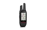
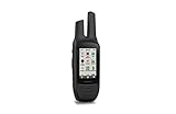
Garmin 3" Garmin Rino 750

ONX Hunt: Washington Hunt Chip for Garmin GPS - Hunting Maps with Public & Private Land Ownership - Hunting Units - Includes Premium Membership Hunting App for iPhone, Android & Web

(Pack of 4) Tempered Glass Screen Protector for Garmin GPSMAP 62 64 64s 64st, Akwox 0.3mm 9H Hard Scratch-Resistant Protective Film for GPSMAP 62 62s 62sc 62st 62stc 64 64s 64st GPS

Garmin Anti-Glare Screen Protectors for Montana

Garmin Universal Carrying Case 010-10117-02

Garmin Montana 610 Camo

Koola Buck Antimicrobial Game Bags (Elk 4 Pack)
Garmin 3" Garmin Rino 755t