
Mapsherpa
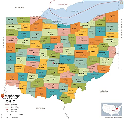
Ohio Counties Map - Standard - 36" x 34.5" Rolled Canvas
Free shipping with 3 or more products in your cart
Payflex: Pay in 4 interest-free payments of R885.50. Read the FAQ
R 3,542
In stock
Duties, insurance and VAT included
Delivered in 10–20 working days —



Free shipping with 3 or more products in your cart
Secure checkout
Your payment is fully protected
Duties & VAT included
No surprise charges at the door
Tracked delivery
Track your order end to end
Returns support
30-day return window
Description
- THE BUCKEYE STATE: The map shows the 88 counties of Ohio and their borders.
- CREATED EXCLUSIVELY: Map has been created for MapSherpa, and designed for business or reference use.
- CLEAR AND CLEAN: Map colors and fonts have been designed for maximum usability & readability. As well as expertly researched by cartographers to ensure accuracy.
- Printed area: 36 x 34.5 inches. Printed directly on canvas and rolled for shipping. There is approximately 5" of unprinted border to allow for stretching the canvas print onto a frame. Ideal for large and decorative maps.
Technical Specifications
Manufacturer
MapSherpa
Color
Multi
Height
87.6 cm
Width
91.4 cm
Shipping & Delivery
Your order is shipped from the USA and delivered to your door in South Africa in 10–20 working days. All items are fully tracked.
Returns & Exchanges
We offer a 30-day return window. If something isn't right, contact our support team and we'll make it right.