

Peters Projection World Map - Laminated
Product Description
Peters Projection World Map - Laminated
- Equal Area
- 3 mil two-sided lamination
- Explanation thumbnails at the bottom of other map projections
- Web links with free downloads for teachers & home-schoolers
- Free B&W outline maps available on-line for practice
The Peters Projection World Map is an equal area projection. That means that one square inch anywhere on the map is an equal number of square miles. All the countries of the world are represented at true size and true proportion. This map is a 2007 edition and does not include updates like South Sudan. There is a newer 2014 edition wall map for sale on AMAZON which is larger -39.5â€x50â€, and omits the right side EXPLANATION panel. There is also a 2015 version which is smaller at 24"x36" and that map comes both with the panels (right and bottom - like this map sold here) and a 24"x36" map with JUST the map (i.e., No panels). This is one of the few commercially available maps that is fair to all peoples. Most maps drastically enlarge the size of the Northern hemisphere countries and diminish the size of the Southern hemisphere countries. This traditional bias leads most people to overestimate the importance of the developed nations based on their inflated appearance. The 1999 Peters map comes laminated (3 mil, edge seal) and rolled in a durable plastic tube. An explanation in enclosed with the map including comparisons to other common projections (Mercator, Van der Grinten, Robinson, Tripel-Winkel, etc.).
Technical Specifications
You might also like

A New View of the World: Handbook to the Peters Projection World Map
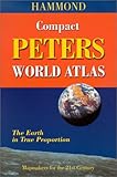
Hammond Compact Peter's World Atlas

What's Up? South! World Map (2x3') folded paper

100 Amazing Facts About the Negro with Complete Proof: A Short Cut to The World History of The Negro
Stolen Legacy: The Egyptian Origins of Western Philosophy