

Rand McNally, New York City 5-Boroughs: Manhattan, Bronx/brooklyn, Queens/Staten Island Street Map
Product Description
Rand McNally, New York City 5-Boroughs: Manhattan, Bronx/brooklyn, Queens/Staten Island Street Map
Rand McNally's folded map for New York City 5 Boroughs: Manhattan/Bronx/Brooklyn/Queens/Staten Island is a must-have for anyone traveling in and around this part of New York, offering unbeatable accuracy and reliability at a great price. Our trusted cartography shows all Interstate, U.S., state, and county highways, along with clearly indicated parks, points of interest, airports, county boundaries, and streets. The easy-to-use legend and detailed index make for quick and easy location of destinations. You'll see why Rand McNally folded maps have been the trusted standard for years.
Regularly updated
Full-color maps
Clearly labeled Interstate, U.S., state, and county highways
Indications of parks, points of interest, airports, county boundaries, shopping malls, downtown & vicinity maps
Enlargments of Manhattan, John F. Kennedy International Airport, Newark Airport and New York City vicinity map
Easy-to-use legend
Detailed index & full street index
Convenient folded size
Coverage Area
Communities Included: Bronx, Brooklyn, Manhattan, Queens, Staten Island
Product Details
Measures 9.5' x 4' and folds out to 40' x 28'.
Technical Specifications
You might also like

Detailed street map of New York City : Bronx, Brooklyn, Queens, Manhattan, Staten Island

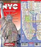
StreetSmart NYC Transit Map by VanDam-Laminated pocket size Transit map w/ subway, bus, ferry and train lines plus attractions in the Five Boros of ... Bronx, Queens & Staten Island, 2020 Edition
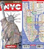
Street Smart NYC Map Midtown Edition by Van Dam-Laminated pocket city street map of Manhattan w/ all attractions, museums, sights, hotels, Broadway Theaters & NYC Subway map; 2020 Edition
StreetSmart NYC Five Boro Map by VanDam-Laminated pocket city street map w/ attractions in all 5 boros of NY City: Manhattan, Brooklyn, Queens, The ... new Subway Map - Folded Map

Easy To Read: New York State Map (Rand McNally Easy to Read!)

Streetwise Manhattan Map - Laminated City Center Street Map of Manhattan, New York (Michelin Streetwise Maps)

Streetwise Brooklyn Map - Laminated City Center Street Map of Brooklyn, New York (Michelin Streetwise Maps)
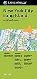
Folded Map: New York City Long Island Regional Map (Rand McNally New York City/Long Island)

Streetwise Manhattan Bus Subway Map - Laminated Subway & Bus Map of Manhattan, New York (Michelin Streetwise Maps)

Rand McNally Easy To Fold: New Jersey (Laminated Fold Map)