

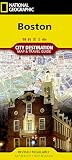
BOSTON Street Map and City Guide
Product Description
BOSTON Street Map and City Guide
MAP NEIGHBORHOOD COVERAGE:
The North End, The South End, South Boston with the convention center, Cambridge including Harvard Square, The Boston Commons, Beacon Hill and the Back Bay.
ON THE MAP:
Museum Highlights & Historical Landmarks
Restaurants, Cafés & Entertainment
Independent, Local, and Luxury Shopping
Centrally Located Hotels
Theatre, Sports, and Performance Spaces
Metro Stops are shown right on the map!
Parks, Gardens & Open Spaces
Accordianfold map: Open: 24 x 9 in / 61 x 23 cm / Closed: 4 x 9 in / 10 x 23 cm
BOSTON HIGHLIGHTS:
Attractions to see on the Red Map Boston include museums such as the Museum of Fine Arts, Isabella Stewart Gardner Museum, the ICA, plus the university museums of Harvard and MIT. For a walk in the park there is the Boston Commons, which is near to the designer shops on Newbury Street, Boylston Street and Copley Plaza. Talk of revolution? Then be sure to see Paul Revere's House, the Old North Church and walk the Black Heritage and Boston Freedom Trails.
Technical Specifications
You might also like

Bostonian's Boston Map

Streetwise Boston Map - Laminated City Center Street Map of Boston, Massachusetts (Michelin Streetwise Maps)
Boston (National Geographic Destination City Map)

DK Eyewitness Travel Guide Boston

Rand McNally Folded Map: Greater Boston Eastern Massachusetts Regional Map

Fodor's Boston (Full-color Travel Guide)

Red Maps PHILADELPHIA Street Map and City Guide

Top 10 Boston (Pocket Travel Guide)