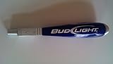
Sky High Bull's-Eye (48"x48") XL Degradable Drone Ground Control Point GCP with 30 Staples (Black/White Checkerboard) | Aerial Targets for Drone Mapping & Surveying | Compatible with DroneDeploy
R 4,863
or 4 x payments of R1,215.75 with
Availability: Currently in Stock
Delivery: 10-20 working days
This item may be available in a different size, colour, scent, version or platform:
Sky High Bull's-Eye (48"x48") XL Degradable Drone Ground Control Point GCP with 30 Staples (Black/White Checkerboard) | Aerial Targets for Drone Mapping & Surveying | Compatible with DroneDeploy
DEGRADABLE GCPS - Ideal for remote ground control points, our burlap GCPs are degradable so that you can leave your GCPs in the field to degrade over time. The control points last up to 1 year depending on weather conditions, ensuring your ground control targets are visible over the entire mapping period.
30 STAPLES INCLUDED - Keep your degradable GCPs anchored with staples that are included with your purchase. Use a staple on each corner as well as once near the center to ensure your GCPs lay flat to the ground and secure during your drone mapping projects.
LIGHTWEIGHT & DURABLE DEGRADABLE TARGETS - With our burlap GCPs, enjoy high visibility while also having the piece of mind that the targets will degrade over time. These degradable targets are made of durable burlap to last long enough to complete the job while remaining visible in various weather conditions through the use of low reflectivity materials.
GCP WITH SOFTWARE COMPATIBILITY - These GCPs are compatible with many popular photogrammetry reconstruction software from the leading companies in the drone mapping, photogrammetry, and surveying space,. The GCPs are compatible with most auto-detection software, and these GCPs have been used in a wide range of industries and educational training programs with great success.
48”x48” AERIAL TARGETS - Designed for drone mapping and scanning as well as low altitude fixed-wing mapping, these GCPs were made for aerial mapping up to 400 feet. The standard size is useful when scaling and verifying the map, providing a standard reference distance during post-processing.