

Southern Rocky Mountain National Park & Indian Peaks Wilderness Trail Map, 6th Edition
Product Description
Southern Rocky Mountain National Park & Indian Peaks Wilderness Trail Map, 6th Edition
Noteworthy points mapped include Longs Pk, McHenrys Pk, Flattop Mtn, Bear Lake, Estes Park, Moraine Park, Glacier Basin, Arapaho Glacier, Jasper Lake, Nederland, Rollinsville, Tollland, Wild Basin, Rollins Pass, Brainard Lake, St Vrain Glaciers, and much more. Please note this map covers about 45% of RMNP: the south eastern portion, the most popular part. 5th Edition has brand new shaded relief that looks great, and every switchback is mapped in eye pleasing clarity.
Technical Specifications
You might also like
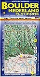
Boulder Nederland Trail Map 4th Edition

Indian Peaks, Gold Hill (National Geographic Trails Illustrated Map)

Best Hikes Colorado's Indian Peaks Wilderness: A Guide to the Area's Greatest Hiking Adventures (Regional Hiking Series)

Rocky Mountain National Park (National Geographic Trails Illustrated Map)

Aspen, Crested Butte & Maroon Bells

Indian Peaks - James Peak Wilderness - Colorado Topographic Hiking Map (2018)

Summit, Vail & Holy Cross Trail Map

Colorado Springs Pikes Peak