

The Premonition Code: The Science of Precognition, How Sensing the Future Can Change Your Life
Product Description
The Premonition Code: The Science of Precognition, How Sensing the Future Can Change Your Life
Technical Specifications
You might also like

all Unit Dose Laundry Detergent, Mighty Pacs, Free Clear, 80 Count

all free clear, Original, Liquid Laundry Detergent for Sensitive Skin, Unscented and Hypoallergenic, Concentrated, 50oz, 66 Loads

all Fabric Softener Dryer Sheets for Sensitive Skin, Free Clear, 195 Count
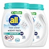
All Mighty Pacs Laundry Detergent, Free Clear Odor Relief, Tub, 56 Count (Pack of 2), 112 Total Loads

all Liquid Laundry Detergent, Free Clear for Sensitive Skin with OXI, Unscented and Hypoallergenic, 2X Concentrated, 90 Loads

all free clear, Original, MIGHTY PACS Laundry Detergent Pacs for Sensitive Skin, Unscented and Hypoallergenic, 66 Count (Pack of 2)

all Laundry Detergent Pacs, Mighty Pacs with OXI Stain Removers and Whiteners, Free Clear, Unscented and Dye Free, 56 Count

all Liquid Laundry Detergent for Sensitive Skin 237 Fluid Ounces