
Kindle Store > Kindle eBooks > Teen & Young Adult > Science Fiction & Fantasy > Fantasy > Fairy Tales & Folklore > Royalty

The Queen's Rising (The Queen’s Rising Book 1)
Product ID: B07192GJLT
Condition: New
Sold Out
Product Description
The Queen's Rising (The Queen’s Rising Book 1)
Technical Specifications
Country
USA
Brand
Quill Tree Books
Manufacturer
Quill Tree Books
Binding
Kindle Edition
ReleaseDate
2019-02-05T00:00:00.000Z
You might also like

Grilling and Campfire Cooking (PB Everyday Cookbooks)

Sunday Dinner at Grandma's: Grandma's Best Recipes for Delicious Dishes Full of Old-Fashioned Flavor, Plus Memories From the Heart (PB Everyday Cookbooks)

Slow Cooking All Year 'Round (Everyday Cookbook Collection)
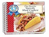
Our Favorite Speedy Slow Cooker Recipes (Our Favorite Recipes Collection)

Our Favorite Vegetarian Recipes (Our Favorite Recipes Collection)

Quick & Easy Recipes for Gatherings (Everyday Cookbook Collection)

From Grandma's Recipe Box (Everyday Cookbook Collection)
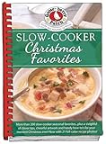
Slow-Cooker Christmas Favorites (Seasonal Cookbook Collection)