

Sangre de Cristo Wilderness & Great Sand Dunes National Park Trail Map 4th Edition
Product Description
Sangre de Cristo Wilderness & Great Sand Dunes National Park Trail Map 4th Edition
Terrain is represented by contours, shaded relief, and color tints. All trails, roads, and historic routes shown. Also mapped: Forest, National Park & Wilderness boundaries. Streams and lakes; newly mapped waterfalls. 8 14,000ft pks, 53 13,000ft pks, numerous other geographic features. Full 5km UTM grid for GPS, Latitude & Longitude as well. Trails rated. Access highlighted with trail heads and gates. Trail descriptions, including location, milage, and elavation gains.
This is a top quality map, the best trail and topographic map of Colorado's Sangre de Cristo. Please note this map does not cover the far northern part of the Sangres near Salida.
Technical Specifications
You might also like

Sangre de Cristo Mountains Great Sand Dunes National Park & Preserve Colorado

Southern Rocky Mountain National Park & Indian Peaks Wilderness Trail Map, 4th Edition

Aspen, Crested Butte & Maroon Bells Trail Map 4th Edition
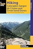
Hiking Colorado's Sangre de Cristos and Great Sand Dunes: A Guide to the Area's Greatest Hiking Adventures (Regional Hiking Series)
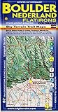
Boulder Nederland Trail Map 4th Edition

Santa Fe, Bandelier & Los Alamos Trail Map 2nd Edition

Steamboat Springs Mount Zirkel Trail Map 3rd Edition

Colorado Springs & Pikes Peak Trail Map 4th Edition