

HUNT Washington Public/Private Land Ownership Topo Maps for Garmin GPS by onXmaps
Product Description
HUNT Washington Public/Private Land Ownership Topo Maps for Garmin GPS by onXmaps
- An essential tool for your hunting arsenal, these fast, intuitive topo maps highlight public and private land owner names and property boundaries.
The HUNT Premium maps add a color-coded layer that lists private and public land owner information and property boundaries. Combining the HUNT line of products with a Garmin GPS and/or computer (using the free Garmin BaseCamp software) these pre-loaded SD/MicroSD cards give you a state-specific color coded map showing land owner names, public lands, hunting districts, topo information, roads, trails, and much more. Endorsed by numerous State and Federal agencies, HUNT by onXmaps is the most reliable source for land ownership maps on the market.
Technical Specifications
You might also like

2 Pack Glass GPS Screen Protector for Rino 750 755T GPS,LFOTPP 9H Tempered Glass Guard Shield Scratch-Resistant Ultra HD Extreme Clarity

(Pack of 4) Tempered Glass Screen Protector for Garmin GPSMAP 62 64 64s 64st, Akwox 0.3mm 9H Hard Scratch-Resistant Protective Film for GPSMAP 62 62s 62sc 62st 62stc 64 64s 64st GPS

ONX Hunt: Montana Hunt Chip for Garmin GPS - Hunting Maps with Public & Private Land Ownership - Hunting Units - Includes Premium Membership Hunting App for iPhone, Android & Web
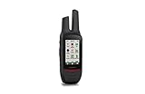
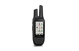
Garmin 3" Garmin Rino 750

Garmin Montana 680t

Garmin GPSMAP 64s Worldwide with High-Sensitivity GPS and GLONASS Receiver

ONX Hunt: Oregon Hunt Chip for Garmin GPS - Hunting Maps with Public & Private Land Ownership - Hunting Units - Includes Premium Membership Hunting App for iPhone, Android & Web
Garmin 3" Garmin Rino 755t

BoxWave Garmin Rino 755t Screen Protector, [ClearTouch Crystal (2-Pack)] HD Film Skin - Shields From Scratches for Garmin Rino 755t, 750

Caseling Hard CASE Fits Garmin GPSMAP 64st 64s 64sc 64 GPS and GLONASS Receiver