

Paradise Cay Publications, Inc.
Paradise Cay Publications, Inc. NOAA Chart 11372: Intracoastal Waterway Dog Keys Pass to Waveland 25 X 36 (Small Format Waterproof)
R 1,021

Captain Segull's Sportfishing Chart
Hudson River, NY - Laminated Nautical Navigation & Fishing Chart by Captain Segull's Nautical Sportfishing Charts | Chart # HR118
R 1,383

Paradise Cay Publications, Inc.
Paradise Cay Publications, Inc. NOAA Chart 11407: Horseshoe Point to Rock Islands; Horseshoe Beach, 34.8 X 44.1, Traditional Paper
R 1,377
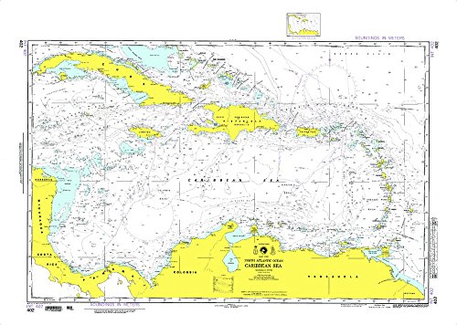
Paradise Cay Publications
Paradise Cay Publications NGA Chart 402WP: Caribbean Sea; 31 X 42.5; Waterproof
R 1,758

NOAA
14883-St. Marys River - Munuscong Lake to Sault Ste. Marie
R 2,107

Paradise Cay Publications
Paradise Cay Publications, Inc. NOAA Chart 11487: St. Johns River Racy Point to Crescent Lake, 33.6 X 29.8, Traditional Paper
R 1,377

NOAA
12348--Coxsackie to Troy
R 2,228
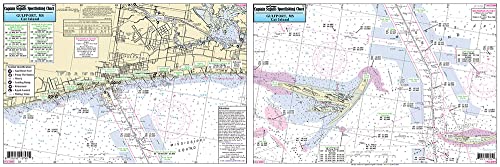
Captain Segull's Sportfishing Chart
Captain Segull Inshore Gulfport to Cat Island MS Fishing Nautical Chart
R 1,451

Captain Segull's Nautical Charts, Inc.
Offshore MA, RI, CT, - Laminated Nautical Navigation & Fishing Chart by Captain Segull's Nautical Sportfishing Charts | Chart # OF10
R 1,812
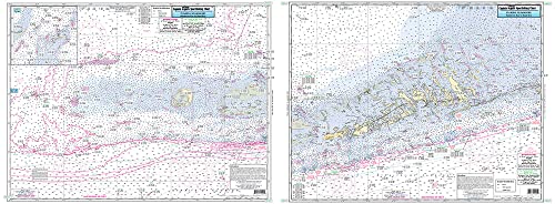
Captain Segull's Sportfishing Chart
Sombrero Key to Dry Tortugas, FL - Laminated Nautical Navigation & Fishing Chart by Captain Segull's Nautical Sportfishing Charts | Chart # SRD37
R 1,812