

Paradise Cay Publications
Paradise Cay Publications NOAA BookletChart 411: Gulf of Mexico
R 1,210

FoldingGuides
Fish-Id Guide Florida Atlantic Coast
R 1,290
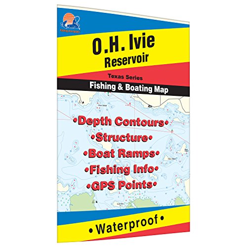
Fishing Hot Spots
O.H. Ivie Reservoir Fishing Map
R 1,290

Waterproof Charts
Waterproof Charts, Lake Fishing, 12F Lake Champlain North
R 2,256
Paradise Cay Publications
Paradise Cay Publications NOAA Nautical Training Chart 1210TR
R 2,174

Captain Segull's Sportfishing Chart
Captain Segull’s Inshore Pine Island, Sanibel Island & Caloosahatchee Fishing Nautical Chart #PIC412
R 1,451

Captain Segull's Sportfishing Chart
Nearshore/Inshore Laguna Madre South, TX - Laminated Nautical Navigation & Fishing Chart by Captain Segull's Nautical Sportfishing Charts | Chart # LMS52
R 1,812

Captain Segull's Sportfishing Chart
Captain Segull Inshore Charlotte Harbor South to North Captiva, FL Fishing Nautical Chart
R 1,451

Fishing Hot Spots
Wright-Patman Fishing Map
R 1,290

Captain Segull's Nautical Charts, Inc
Big Pine Key to Key West, FL - Laminated Nautical Navigation & Fishing Chart by Captain Segull's Nautical Sportfishing Charts | Chart # BK349
R 1,451