

Fishing Hot Spots
Lac Vieux Desert Fishing Map
R 1,250

Paradise Cay Publications
Paradise Cay Publications NOAA BookletChart 12206: Intracoastal Waterway Norfolk to Albemarle Sound via North Landing RIV.
R 1,210

Captain Segull's Sportfishing Chart
Captain Segull’s Loran Line Reference Chart #LR12200
R 1,021
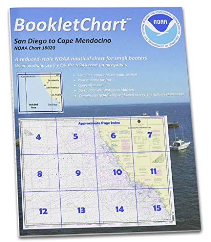
Paradise Cay Publications
Paradise Cay Publications NOAA Booklet Chart 18020: San Diego to Cape Mendocino
R 1,210
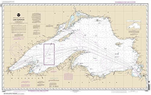
Paradise Cay Publications, Inc.
Paradise Cay Publications, Inc. NOAA Chart 14961: Lake Superior (Mercator Projection), 27.1 X 42.8, Traditional Paper
R 1,638

Paradise Cay Publications, Inc.
Paradise Cay Publications, Inc. NOAA Chart 11430: Lostmans River to Wiggins Pass, 25.5 x 36, Small Format Waterproof
R 1,021

Captain Segull's Sportfishing Chart
Captain Segull's Offshore Loran Line Highlight Off MA, CT, RI, NY & NJ Nautical Chart # LR12300
R 1,451

Art to Media
Art to Media Dive Map - Hoyt S. Vandenberg
R 1,332
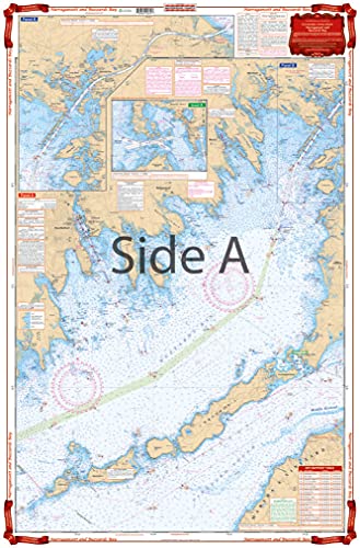
Waterproof Charts
Waterproof Charts, Standard Navigation, 61 Narragansett and Buzzards Bay, Easy-to-Read, Large Print, Waterproof Paper, Tear Resistant, Printed on Two Sides, 2 Charts in 1, NOAA Charts
R 2,256

Captain Segull's Sportfishing Chart
Captain Segull Inshore Port Royal, SC to Savanah, GA Fishing Nautical Chart
R 1,451